Central Lathrop

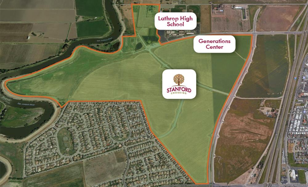
Saybrook CLSP LLC - Stanford Crossing
The Central Lathrop Specific Plan (CLSP) project area consists of approximately 1,521 acres located north of Mossdale Village on the Westside of Interstate 5. The property was annexed into the City of Lathrop in 2005. The project land uses include roughly:
- 700 acres of low density residential
- 45 acres of medium density residential, and
- 28 acres of high density residential
- Other land uses include approximately:
- 340 acres of commercial land
- Lathrop High School
- Lathrop Generations Center
- 36 acres of K‐8 school sites
- 100 acres of community and neighborhood parks
- 11-acre site for the Civic Center
- 94 acres of open space along the levees
A Tentative Map was approved for 1,040 single‐family lots. The City also approved a Tentative Map for 418 single-family lots on the 94-acre site adjacent to the Generations Center.
The City of Lathrop is currently working with the San Joaquin Area Flood Control Agency regarding the implications of the SB‐5 200‐year flood protection legislation and implementation measures needed to meet adequate progress. The City also recently adopted the formation and levying of Community Facility District 2019-2 for the project area, which allows for the development to begin construction.

Contact Information
Stephen J. Salvatore, City Manager
Phone: (209) 941-7220
citymanager@ci.lathrop.ca.us
Lathrop Emergency Operations Center
Phone: (209) 941-5111
eoc@ci.lathrop.ca.us
https://www.ci.lathrop.ca.us/covid19
Residents with questions about COVID-19 Resources in San Joaquin County can also Call 2-1-1